
Trekking Map
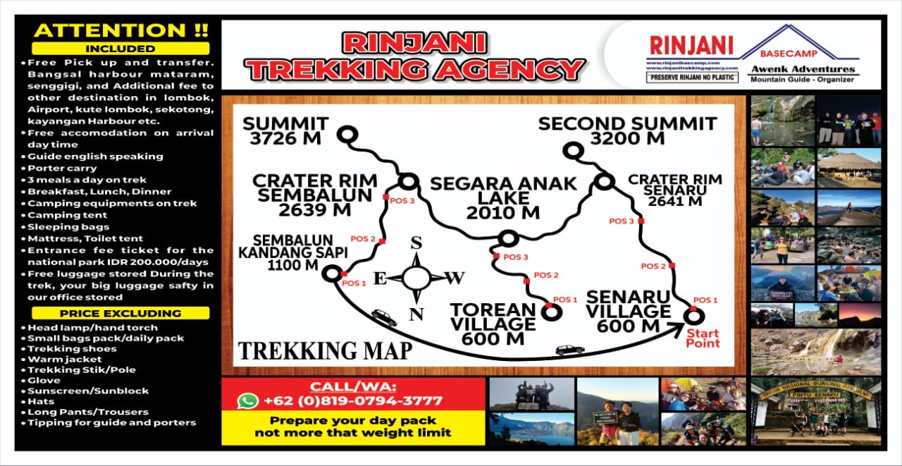
Trekking Map admin July 10, 2025 General Information A Guide to the Mount Rinjani Trekking Map Navigating the


Trekking Map admin July 10, 2025 General Information A Guide to the Mount Rinjani Trekking Map Navigating the

Mount Rinjani National Park admin July 10, 2025 General Information Discover the Majesty of Mount Rinjani National Park

Villages Around Mt Rinjani admin July 10, 2025 General Information The Gateway Villages of Mount Rinjani: Senaru and
Mount Rinjani Ascent Routes admin July 10, 2025 General Information A Guide to the Ascent Routes of Mount